by EAGLE Students | Oct 20, 2020 | 2018 EAGLEs, Magdalena Halbgewachs, Notes
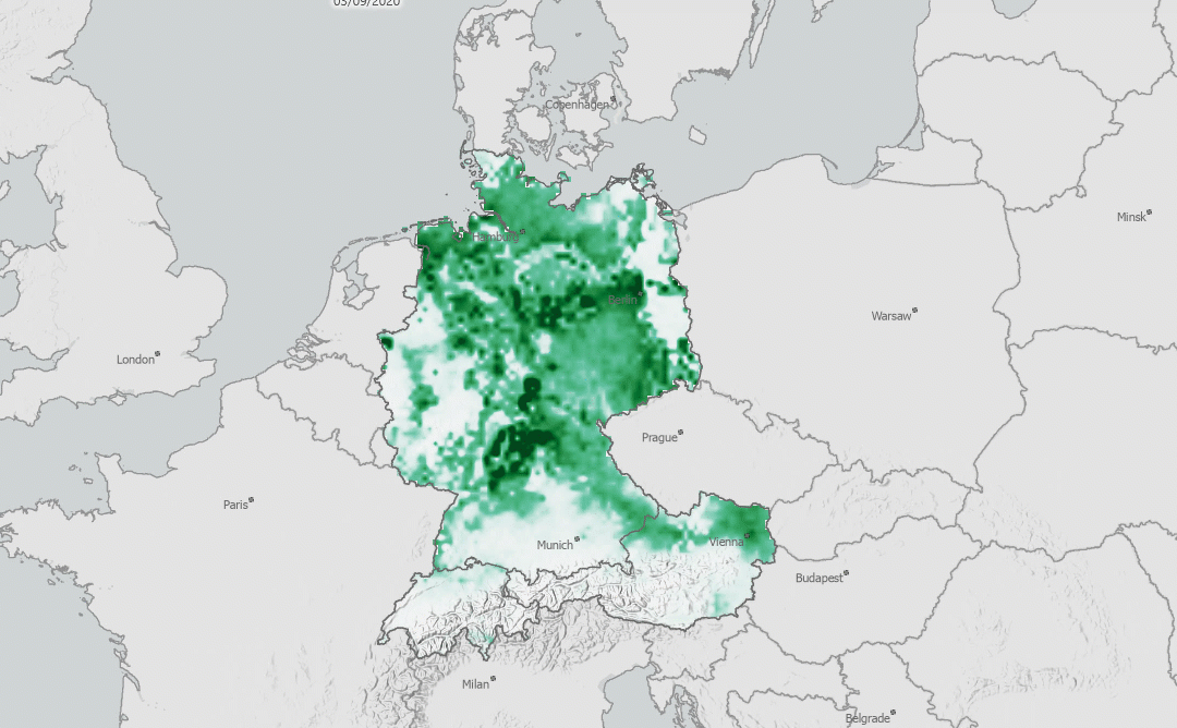
written by Magdalena Halbgewachs Sentinel-5P is a satellite that is operating within ESA’s Copernicus program since 2017. The goal of the mission is a very dense scheduled operational monitoring of the atmosphere. Using the TROPOMI instrument on board, various...
by EAGLE Students | Aug 2, 2020 | 2018 EAGLEs, Henrik Fisser, Notes
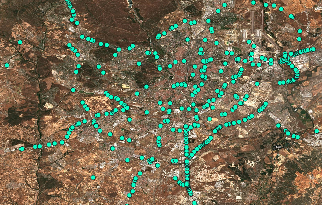
Why can we detect trucks using Sentinel-2 data? Earth observation is delivering significant insights that help us to understand consequences the drastic crisis has on the environment, the people and the economy. I would like to tell you about how I could contribute...
by EAGLE Students | Oct 29, 2019 | 2017 EAGLEs, Marius Philipp, Notes
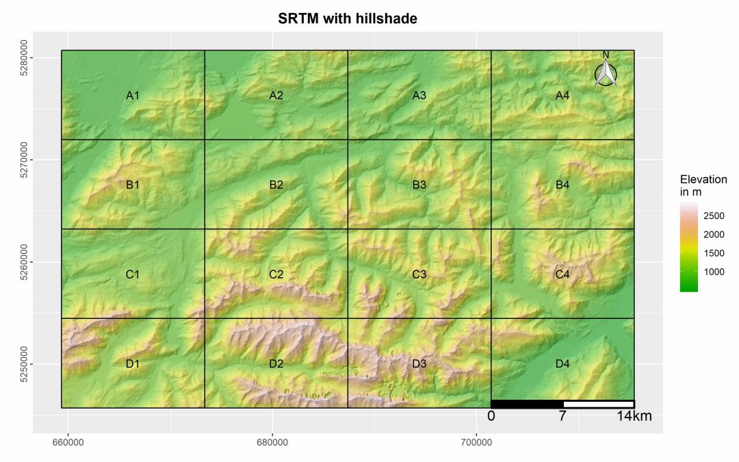
This R package was designed by EAGLE student Marius Philipp for the automatized generation of map booklet pdfs for user defined ggplots. The package contains currently two functions, one of which creates a fishnet polygon from the extent of the user input data. The...
by EAGLE Students | Jul 13, 2019 | 2017 EAGLEs, Marius Philipp, Notes
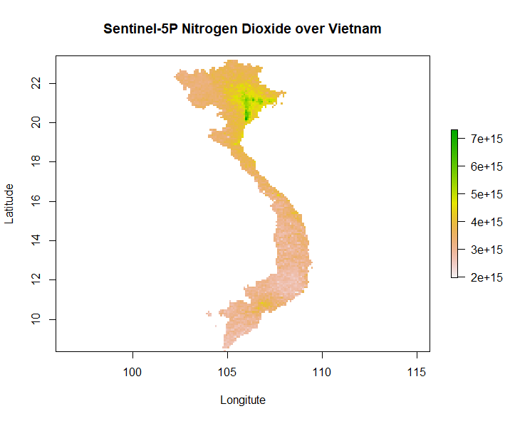
Our second generation EAGLE student Marius Philipp developed the R package S5Processor to automatically convert Sentinel-5P L2 NetCDF files into TIFF files. The user can define the product which should be turned into a TIFF and also mosaic from a list of file-paths....

by EAGLE Students | May 10, 2019 | 2017 EAGLEs, Aida Taghavi Bayat, Notes
In a few days, me and some other EAGLE program students are going to attend the “Living Planet Symposium 2019” by ESA which is amongst the biggest Earth observation conferences in the world. Part of my internship work at Remote Sensing Solutions GmbH is going to be...
by EAGLE Students | Mar 22, 2019 | 2017 EAGLEs, Internships & Innovation Lab, Notes, Salim Soltani
The internship at DLR gave me the opportunity to contribute to a case study investigating the effect of spatial resolution on the snow classification accuracy using different sensor images using Spot-5, Sentinel, Landsat, and MODIS for the time frame of 1984 to 2018....