
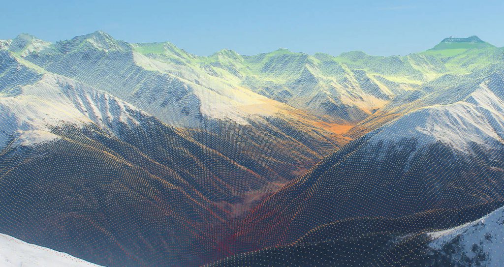
DEM points projected to image plane.
Over the last years, webcams and real-time monitoring has become more and more popular. Especially in mountainous regions webcams are widespread (e.g. ski fields, lakes, traffic, …). As these images provide information in high spatial and high temporal resolution, the question the scientific community is rising and trying to answer is, whether this data could be usable for spatial analysis purposes. The major challenge in this case is to properly georeference webcam images to a map coordinate reference system. Even though from a geometric point of view this can be solved, many parameters are very difficult to be measured in an accurate way (e.g. orientation of the camera system). Therefore, beside the geometric parameters the standard approaches use ground control points (GCPs) that are accurately measured in the field to align the image.
During my innovation lab at the European Academy (EURAC) in Bolzano, I developed the proposed python package georef_webcam providing a tool to georeference webcam images very accurately without knowing all the projection parameters very accurately. It is also compensating the need to go into the field personally, as you can derive GCPs from remarkable man-made structures or from morphological features (edges) in the panoramic view of the image and the Digital Elevation Model (DEM). As cameras are no ideal systems, they usually induce distortions into the image, which must be compensated for accurate georeferencing. The proposed tool is implementing a new approach of polynomial fitting to compensate these errors. The whole georeferencing procedure is wrapped up in a command-line based python script, which is making this procedure as user-friendly as possible. There is no need to deal with the projection procedure itself. The user is just asked for the needed parameters and to draw the GCPs and the Fitting points in a predefined QGIS project. All substeps can be executed iteratively to produce a result that meets the user requirements.
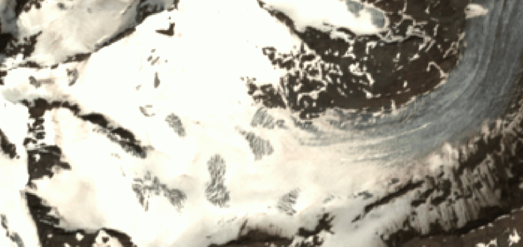
Animation showing Sentinel-2 image overlayed with projected webcam image.
As this script is in early development stage, I cannot guarantee for its full functionality. However, If you want you can also visit to my Github for more information.
References:
Härer, S., Bernhardt, M., and Schulz, K.: PRACTISE – Photo Rectification And ClassificaTIon SoftwarE (V.2.1), Geosci. Model Dev., 9, 307-321, doi:10.5194/gmd-9-307-2016, 2016.
Webcam images were provided by foto-webcam.eu